











Our reward for hot summers is the beauty and last hurrah of autumn leaves. Carole Jacobs, Real Food Traveler’s Health & Fitness Editor, is as passionate about the fall foliage as she is about finding unique places to enjoy it. Here, she provides us with a roundup of places to go in the United States that don’t always get all the hoopla. Off the beaten track, they are just as glorious as more popular places but with far fewer crowds. Let this list be your guide to a fabulous fall.

Save this article to Pinterest to help you plan your trip around the U.S. to see autumn colors off the beaten path. Graphic by RealFoodTraveler.com.
I’m with French author and philosopher Albert Camus, who once said “Autumn is a second spring when every leaf is a flower.” While I’ve never had the time to fulfill a life-long fantasy of chasing fall as it erupts across the country, igniting mountains, plains and prairie in a breathtaking mosaic of reds, yellows, and oranges, I’ve taken many road trips around the U.S. for the sole purpose of admiring the flaming foliage, sticking to off-the-beaten-path places where the seasonal splendor (rather than throngs of tourists and traffic) can speak for itself. Below are a few of my favorite viewing spots.
10 Places to see Autumn Colors that are Off the Beaten Path in the United States
Mid-September through early October
- Eastern Sierra, Inyo and Mono Counties, California
Most people equate the Eastern Sierra –home to Mt. Whitney, Mammoth Lakes, Yosemite National Park, and Lake Tahoe, with the famous author and naturalist John Muir, not fall foliage. But IMHO, the autumnal splendor in my high-altitude backyard more than rivals the show I enjoyed growing up in Pennsylvania, albeit in a completely different, un-deciduous way. Depending on the elevation, the aspen, larch, cottonwoods and underbrush in this 250-mile-long by 80-mile-wide mountain range, turn from mid-September through late October. In late September, the flaming aspen along 29-mile Sonora Pass, which corkscrews to 10,000 feet as it crosses the rugged summit of the Sierra, light up the evergreen slopes, grassy meadows and sculpted granite peaks in electric shades of gold, orange, and red. In many ways, the scenery and fall colors here rival what you’d see on Sonora’s far-most-famous sister pass to the south –Tioga Pass, the stunning but mobbed highway to Yosemite, which now requires a reservation to drive during daylight hours).

The view near Sonora Pass. Photo by Carole Jacobs.
Between Sonora Pass and Lone Pine, several other paved roads climb the steep flanks of the Eastern Sierra from Scenic Highway 395, coiling to alpine wonderlands set at 10,000 feet that cradle bowls of flaming aspen, crashing waterfalls, alpine meadows tipped with burnt gold and crimson, deep pine forests lit by stands of glimmering yellow, red, and orange aspen, and trails that coil to aquamarine lakes, granite peaks, and glaciers. The fall show is especially stunning at Lundy Lake, Rock Creek Canyon, Onion Valley, and the 16-mile June Lake Loop, which follows a horseshoe shaped canyon hemmed in by towering peaks that links four aquamarine lakes rimmed by glowing aspen. (June Lake is called “Little Switzerland” for good reason.) The Leaves in the Loop fall festival, in October, is the charming little town’s ode to fall, with food, crafts, photography and painting classes, and historic tours. For updates on fall foliage in the Eastern Sierra, visit Mono County’s Fall Color Guide and Map, and Bishop’s Eastern Sierra Fall Foliage updates, guide and map.
2.San Juan Skyway Scenic Byway, Colorado
Jaw-dropping cliffs, dramatic scenery and mile after mile of dazzling autumnal amber, bronze and gold foliage define the “Road to the Sky” loop (called the Mission Dollar Highway due to the cost of construction) as it dips into the 5-million-acre San Juan and Uncompahgre national forests and passes through the classic Colorado mountain towns of Telluride, Durango and Ouray. The 236-mile byway traverses the San Juan Mountains from Durango to Cortez as it rollercoasters from golden ranchlands and pastures to evergreen slopes dotted with gem-like lakes and waterfalls and over several 10,000-foot-plus passes overlooking dizzying views of flaming foliage. Pull over to see aspen glowing against red rock cliffs at Mesa Verde National Park or Canyons of the Ancients; catch the flaming aspen aboard the Durango and Silverton Narrow Gauge Railroad, ride the free gondola in the ski town of Telluride for a bird’s eye view of torched hillsides; or gaze up at rugged slopes decked out in reds, yellows and golds while floating in natural hot springs in historic Ouray, Ridgway, or Pagosa Springs. Over the past several years, the colors in the San Juan Mountains tend to start mid-September near the historic rough-and-tumble ghost mining town of Silverton and finish up early to mid-October around Pagosa Springs, Purgatory Ski Resort above Durango, and in Dolores, set in a dramatic, color-drenched canyon. For fall color updates, go here.
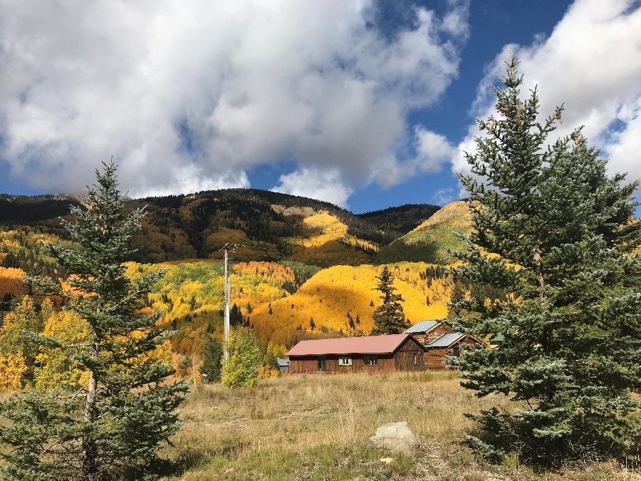
The San Juan Skyway in Telluride. Photo by Carole Jacobs.
- North Cascades Scenic Byway, Washington
This 140-mile byway spans the section of the 440-mile Cascade Loop from Twisp in the Methow Valley to Sedro-Woolley, in the Skagit Valley, passing through classic Methow Valley Country, which looks like a movie set from a spaghetti western, where fresh cut hay and farmland glow golden in the sunlight and there’s a farmer’s market overflowing with just-picked produce around every bend in the road. The byway ascends into the jaw-dropping North Cascades National Park, winding through ragged peaks, craggy spires, crashing waterfalls and glinting glaciers–the North Cascades are often called the “North American Alps”– and then into the pastoral Skagit Valley. Leaves all along the byway change color, with some stretches saturated with blazing yellow aspen; others a riot of vibrant red oak. Orchards, vineyards and farmlands along the glacier-fed Wenatchee River from Leavenworth to mirror-like Lake Chelan are aglow in gold, red, and orange. Both The Today Show and Condé Nast Traveler described Leavenworth as a top destination for unique fall foliage, so time your visit to coincide with the quaint Bavarian town’s Autumn Leaf Festival in September, when flaming foliage serve as a colorful backdrop to the sound of oompah music inviting you in for a sampling of bratwurst, sauerkraut, and schnitzel in German-style beer gardens. With its intricate Bavarian architecture, wine and cedar tasting rooms and concerts on the gazebo, Leavenworth is reminiscent of a small alpine village tucked into the highest peaks of Europe. Or, as The New York Times wrote, “It’s like living in a snow globe.”
Early October to late October
4.Door County, Wisconsin
Tucked into a narrow peninsula between bustling Green Bay and Lake Michigan, Door County is a sea of color when the trees turn Technicolor. Come for scenic drives past miles of glimmering sugar maple, beech, birch, red oak and ash, plus more downhome fall festivals than you can shake a stick at –from cider pressing and pumpkin patch parties to craft, quilt, and food and wine fetes celebrating Door’s annual harvest (apples, pears, berries, cherries, cheese, wine, and whitefish, which star in Door County’s historic fish boils.
The 66-mile-long Door County Coastal National Scenic Byway zooms past bluffs and sandy dunes along Lake Michigan before its grand finale at Jens Jensen Winding Road, a tunnel of blazing trees. En route, brake for Ellison Bay Bluff County Park, where wooden boardwalks overlook sheer, 100-foot limestone cliffs above Lake Michigan and an enclosed catwalk extends out over the bluffs for a birds-eye view of blazing trees reflected in the lake.
Or, to see how autumn paints both sides of the peninsula, drive from the stunning waterfront villages of Sister Bay and Bailey’s Harbor to Ridges Sanctuary in Bailey’s Harbor, a National Natural Landmark with miles of blazing foliage and two lighthouses. On 8.7-acre Cana Island, climb the 97-step spiral staircase to the top of the 1869 lighthouse for blazing panoramas. Then continue across Kangaroo Lake for panoramas of serene lowland marshes tinged in autumnal hues. For updates on local fall color, go here.
Hungry for more? Here’s an itinerary for 3 perfect days in Door County in the Fall.
- Taos, New Mexico
Come fall, the aspen in and around Taos explode in gold and crimson along sky-high scenic drives, atop scenic chairlifts, and aboard the country’s most spectacular steam railroad.
The most famous scenic drive in Taos is the 85-mile Enchanted Circle Scenic Byway, which meanders through mountains, canyons, ranches and pint-size towns awash in fall color in its loop around 13,161-foot Wheeler Peak. Brake for the Red River Oktoberfest in October, featuring German beer, food and lederhosen, and get a bird’s eye view of flaming forests on the Chile Express Chairlift at Angel Fire Resort, which lifts you to a breathless 10,0000 feet.
Another beautiful fall scenic drive is the High Road to Taos Scenic Byway between Taos and Santa. The High Road roams through an authentic remnant of Old Spain as it passes through creased and crinkled badlands and historic villages torched with yellow and orange. Or drive Highway 64 between Tres Piedras and Tierra Amarillo, a 78-mile drive in Carson National Forest that’s one of the state’s highest roads, showcasing stunning fall foliage as it spirals to 13,528-foot Brazos Summit.
Or head to the enchanting village of Chama and leaf peep aboard the historic 64-mile Cumbres & Toltec Scenic Railroad, the longest and highest steam railroad in North America. The little train-that-could chugs through spectacularly rugged mountains, crossing state borders 11 times, zigzagging along canyon walls, burrowing through two tunnels, and steaming over the 137-foot Cascade Trestle, which spans a rocky gorge where the deer and the antelope (and the elk, fox, eagles. and bear) play. Taos, an art colony, is justly famous for its year-round calendar of festivals. Time your fall visit to coincide with the Taos Fall Arts Fest, September into October, or the Taos Mountain Balloon Rally in October, when colorful balloons dance across the Taos sky.
- Historic Hills, Iowa, and Parke County, Indiana
Looking for a place that takes you back to the autumns of your (or your parents or grandparents) childhood? You may find yourself sharing the road with horses and buggies on Iowa’s Historic Hills Scenic Byway, a 105-mile route through rolling hills, extensive forests and 20 towns in southeastern Iowa’s Amish and Mennonite country. A slew of deciduous trees – from red oak to yellow hickory- paint the countryside yellow, orange and red in fall, and the region hosts the Scenic Drive Festival, in October, where all the villages in the region host arts and crafts fairs, pancake breakfasts, garage sales, parades, car and motorcycle shows, and homestyle food (there’s not a single fast food joint along the byway).
Or enjoy a nostalgic-drenched autumn in Parke County, Indiana, aka “The Covered Bridge Capital of the World.” The county is home to 31 historic covered bridges–the nation’s highest concentration–many built in the 1800s and still in use, and all especially charming nestled amid the area’s blazing fall foliage and sweeping golden farmlands. The half-century-old Parke County Covered Bridge Festival, in October, showcases then all, with villages along the route hosting a variety of fall festivities.

Covered bridge in Parke County, Indiana. Photo courtesy Unsplash.
New England’s (Fall Foliage) Roads Less Taken
New England is justly famous for its blazing fall foliage – and unfortunately, with that notoriety comes crowds. In autumn, you can barely see the forest for the cars!
Fortunately, with its 32 million acres of forest, miles of patchwork quilt farm landscapes, and scores of historic villages frozen in time with white steepled churches, quaint general stores, stone walls and covered bridges, New England offers countless quiet alternatives to the autumnal bumper-to-bumper traffic found at Stowe, Vermont’s Smuggler’s Notch; New Hampshire’s Kancamagus Highway; Maine’s Acadia National Park; and Massachusetts’s Mohawk Trail.
The narrow winding road over Smuggler’s Notch mountain pass near Stowe may deliver OMG views of the terminally quaint village, but Rt. 58 from Lake Willoughby to Hazen’s Notch offers all the foliage and scenery minus the mobs. Nestled between two fjord-like mountains, Lake Willoughby, a glacier lake, is a beautiful beginning to a scenic drive through charming villages with mountain views, across covered bridges – the road even briefly turns to dirt near the city of Lowell—proof of its off-the-grid status.
Skip New Hampshire’s crowded “Kan” Highway and drive Evans Notch (Route 113) along the Maine-New Hampshire border in the White Mountains instead. This tranquil scenic route carves a steep, winding path through a tunnel of blazing maple, birch, and beech trees; passes Basin Pond, an aquamarine gem of the White Mountains, and accesses trailheads that climb to spectacular waterfalls and high mountain vistas.
Instead of battling bumper-to-bumper traffic along Acadia National Park’s loop road, head for the Camden Loop, which winds from the classic Maine town of Camden past mountains that crash to the sea and lakes fringed with flaming foliage.
Finally, bypass the Berkshire’s famed 60-mile Mohawk Trail, New England’s first official scenic tourist route, which has seen millions of drivers since 1914, for Jacob’s Ladder Scenic Byway, part of Route 20, a 3,356-mile interstate between New England and the Pacific Northwest. The Jacob’s Ladder Byway through historic (1765) Becket winds over the highest point of the highway east of the Mississippi, and through a New England patchwork quilt of flaming forested hills, fields torched by autumn, quiet wetlands, steep rock ledges, mountain views, and charming villages. Becket may be off the beaten path, but its Jacob’s Pillow Dance Festival, set in an 18th century farmhouse and barn, draws performers from the world over.
Hungry for more? Get Carole’s guide to the best places to see Northern Lights.
- Pocono Mountains, Pennsylvania
The Pocono Mountain’s fall foliage can be seen in a mountainous region that encompasses 2,400 square miles of hills, forests, lakes, rivers and tumbling waterfalls. An easy drive from both Philadelphia and New York City, The Poconos are where stressed-out urbanites go to chill, spa, hike, swim, ski, and wine-and-dine, and where I spent many childhood summers camping out and cooling it in its crystal lakes.
A scenic drive to the summit of Camelback Mountain in Big Pocono State Park delivers spectacular fall panoramas. Or head to the Delaware Water Gap National Recreation Area. The Delaware River winds between mountains ablaze with russet and golden hues, offering eye-popping views from the water, from hiking trails set high on the cliffs above, and in forests that frame thundering waterfalls, including the state’s two highest: Raymondskill Falls and Dingmans Falls.
Pocono Environmental Education Center’s annual Harvest Festival is held in October, so you’re your calendar.
Leaf peepers also flock to the rocky outcroppings above the Lehigh River at Lehigh Gorge State Park, which hosts the Annual Rocktoberfest in early October.
Just minutes up the road is the Victorian town of Jim Thorpe, set off perfectly by seasonal hues. Come for the Jim Thorpe Fall Foliage Festival held the first four weekends of October and hop aboard the Lehigh Gorge Scenic Railway for an Autumn Leaf Train Excursion.
On the northern end of the Poconos region, scenic Route 6, another fall stunner, winds west from the Delaware River past Shohola Marsh Reservoir before turning north at mirror-like Lake Wallenpaupack and following the Lackawaxen River, en route linking Milford, Hawley and Honesdale, charming towns with picturesque, historic downtowns lined with colorful trees that host harvest celebrations.
Waterfall Byway Scenic Drive/Highway 64 in North Carolina
In my mind, the only thing more magical than flaming fall colors is flaming fall colors with waterfalls. The 98-mile Waterfall Byway (Highway 64) from Rosman to Murphy in western North Carolina, more than fits the bill as it winds past more than 200—count ‘em—cascades in Transylvania County, aka “The Land of Waterfalls,” and located about an hour south of Asheville.
After crossing the famous French Broad River, you’ll come to Toxaway Falls, which plunges into Lake Toxany. A few miles on is Sapphire, one of several bucolic mountain towns in North Carolina’s “Little Switzerland,” where a side road leads to Gorges State Park, home to Rainbow and Turtleback Falls. Past Whitewater Falls, the highest waterfall east of the Rocky Mountains which drops nearly 1,000 feet in two tiers, is the historic resort town of Cashiers, one of the region’s oldest resort towns and a perfect place to rest your braking foot before tackling the 12 very windy miles to the resort town of Highlands, at 4,188 feet the highest incorporated community on the East Coast.
Stretch your legs along picturesque Main Street, adorned with flower baskets hanging from light poles. Refuel at one of the sidewalk cafes before taking a 2.4-mile roundtrip hike to nearby Glen Falls, a triple waterfall where observations decks overlook the cascades.
From there, the scenic route heads across Lake Sequoyah to Bridal Veil Falls, a 120-foot-tall drive-by waterfall. Pull over and walk under the falls for a refreshing natural shower. (You could once drive under the waterfall, but it’s been closed to cars.)
A little further along is Dry Falls, so named because you can walk behind it without getting wet. Six miles away is Cullasaja Gorge, where the road narrows and clings to steep cliffs. Soon you’ll see Cullasaja Falls, which plunges 310 feet into the gorge and is a popular fly-by for circling falcons.
There are no signs marking the location of Bust Your Butt Falls, but parking on both sides of the road will clue you in. At the base of a cascading waterfall is a swimming hole you can only reach by sliding down a natural waterslide on your butt.
The highway continues to Winding Stair Gap, one of the earliest western passages along the famous Appalachian Trail, then heads along the ridge lines of the Chunky Gal Mountain, delivering drop-dead views. From here, the road beelines through colorful forest, past mountain views, and across a 331-foot-long span bridge (the state’s longest) before rolling into historic (1830s) Murphy, where you can unwind over a glass of wine at Nottely River Valley Vineyards,
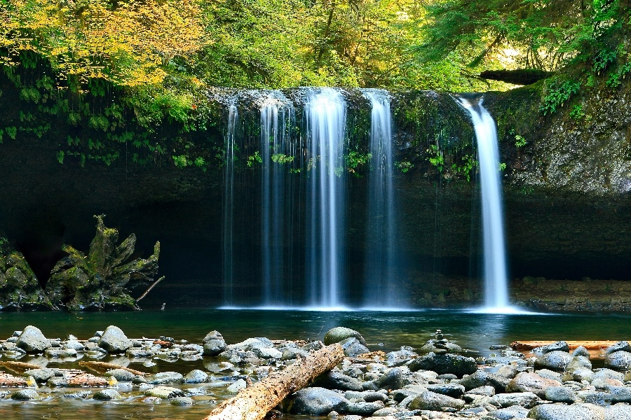
The Waterfall Byway in North Carolina. Photo courtesy Unsplash.
- Clayton, Georgia
Tallulah Gorge State Park in the Victorian resort town of Tallulah Falls is a dramatic place to embrace fall, with a 1,000-foot-deep gorge; six waterfalls, including Tallulah Falls and Hurricane Falls; and a suspension bridge that sways 80 feet above the rocky bottom, delivering awesome views of the river and waterfalls. Tightrope walkers have twice crossed the gorge, and visitors can still see towers used by German-American high-wire artist Karl Wallenda.
Get an overview of the park at the park’s Jane Hurt Yarn Interpretive Center, where an award-winning film takes viewers on a thrilling journey through the gorge, including footage of rock climbers and kayakers. Then hit the rim trails for spectacular views into the canyon or get a permit to hike to the bottom.
After touring the park, head to the nearby Bavarian-inspired village of Helen for beer, brats, bands and Lederhosen at the country’s longest-running Oktoberfest, held in September and October. Held at Helen Festhalle, a German-inspired beer hall, the event features German-style bands from around the country and world who blow Alphorns, ring cowbells and squeeze accordions, prompting costumed guests to hit the dance floor and Polka.
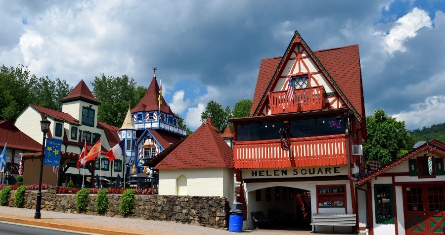
The Helen George Village. Photo courtesy Unsplash.
-Story by Carole Jacobs, Health & Fitness Editor, Real Food Traveler
Get started planning your leaf-peeping journey around the U.S. with this Expedia affiliate link or this Hotels.com affiliate link for Real Food Traveler.









0 Comments