











Leaf-peeping season lingers in certain parts of the country far longer than in other areas. In this article by Real Food Traveler’s Health, Fitness and Spa Editor, Carole Jacobs. Through this personal account, she has put together a great plan for the best places to see fall colors in California’s High Sierra. Make plans for a quick trip now or plan ahead for next year.
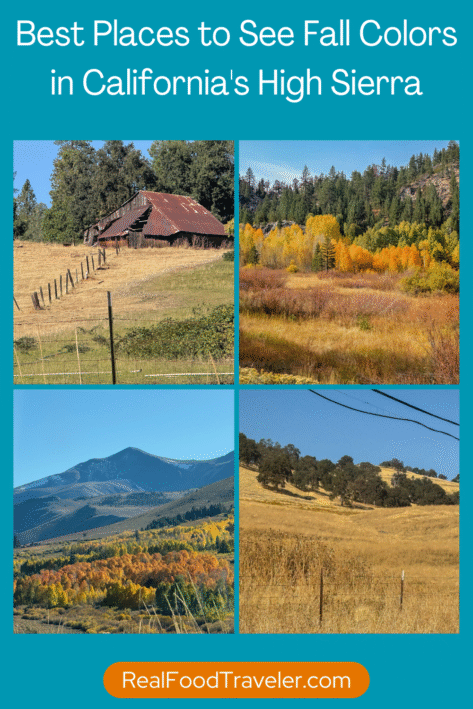
Save this plan for the best places to see fall colors in California’s High Sierra to Pinterest to plan your trip. Photos courtesy of Flickr. Graphic by RealFoodTraveler.com.
Hungry for more? Holiday adventures in the Arizona desert.
Best Places to See Fall Colors in California’s High Sierra
As a reluctant California transplant from the Northeast where autumn is akin to religion, I’ve always taken fall seriously.
And while I’ll always have a soft spot for Vermont’s white steepled villages and rolling seas of flaming deciduous, California’s High Sierra takes autumn to another level—literally.
This October, when the air acquired a snap and the aspen begam to shimmer, I headed for the hills with Zoe, my Australian Shepherd rescue dog.
I couldn’t have found a better copilot: Dumped in the inhospitable Mojave Desert, Zoe had wandered for weeks, the sand and sagebrush her only companions. She finally emerged near an elementary school playground, where a crew of pint-sized guardians delivered her to their teacher, who delivered her to an animal shelter, who delivered her to me. With her unerring GPS, Zoe would keep me on track during my drive up and over four of the High Sierra’s wildest and most remote mountain passes.
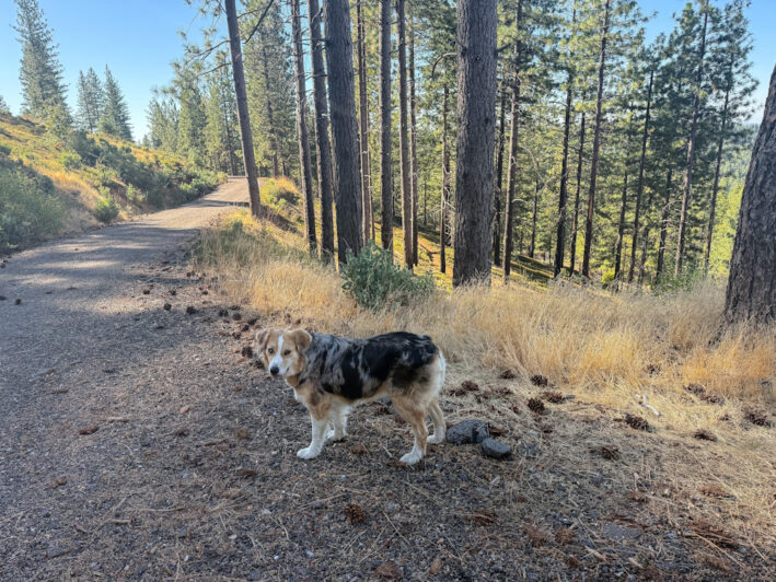
The author’s dog, Zoe.
The longest autumn on earth
The High Sierra has what marketing folks bill as the country’s longest autumn – a result of the region’s vast ranges in elevation — from 2,000 feet in the desert and 3,000 feet in the valleys to 4,000 feet in the foothills and 14,000-plus feet in the highest peaks.
In early September, the aspen in the high country kicks off the annual autumnal display in a fiery display of gold, orange, and crimson. As fall progresses, the colors spread down the mountains to the foothills, valleys, and finally to the desert, where the last call of fall occurs in early December.
My journey to fall would take me thousands of feet up, over, and back down and around the most storied mountain passes of the High Sierra, a 400-mile-long mountain range of untamed wilds held together mostly by its emptiness.
I ’d coil from the sagebrush flats of the Mojave Desert to jagged peaks dusted with the season’s first snow; cross high mountain plateaus where cliffs, domes, meadows, lakes, and cascades are the legacy of bygone glaciers; and plunge down through impenetrable pine forests to bucolic farms and vineyards nestled in the sunny foothills. En route, I’d stop for the night in historic mining towns immortalized by the 49ers, where the Gold Rush past still lives on.
A Plan for Taking in the Best Places to See Fall Colors in California
Night 1: North to June Lake
From my home in Kennedy Meadows in the southern High Sierra, a precipitous two-laner plunges down between rocky cliffs and sheer drop-offs with no guardrails to the desert. There, Highway 395 links a series of tiny towns that hover beneath the wall-like Eastern Sierra, which sweeps up from the high desert flats to a horizon crowded with jagged peaks.
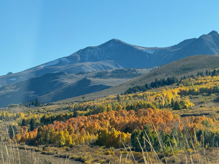
Highway 395, north of June Lake. Photo courtesy of Flickr.
Past Lone Pine, where Hollywood Westerns were shot in the foothills beneath towering Mt. Whitney, at 14,505 feet the highest peak in the lower 48 states, the highway heaved and sighed up through desert solitaire to Independence, a lonely outpost that inspired author Mary Austin’s The Land of Little Rain. Further along, Big Pine hovers beneath 12,400-foot Palisade Glacier, the southernmost glacier in America that one day will no longer exist.
At Bishop, “a small town with a big backyard” that draws hikers, backpackers, and anglers the world over, we left the desert for the evergreens, switchbacking up past Mammoth Lakes, LA’s year-round recreational escape hatch where millionaire mansions nestle on the flanks of a supervolcano that’s one of the earth’s largest calderas, and on to June Lake, nicknamed “California’s Little Switzerland” for its impossibly picturesque setting in a rugged canyon of aquamarine lakes rimmed by crag-toothed peaks. We nabbed a rustic cabin at Silver Lake Resort, where Hollywood celebs like Charlie Chaplin and Ingrid Bergman came to chill, hike, and fuel up at the resort’s rustic little cafe, famous for serving the best breakfast in the High Sierra.
The next morning, we followed the June Lake Loop past steep evergreen mountains lit by iridescent gold, orange, and red back to Highway 395 for the push north to the first pass of the journey.
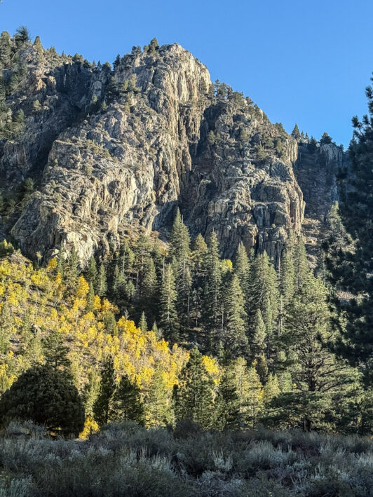
The June Lake Loop.
Past Tioga Pass, which winds up to Yosemite National Park, and Sonora Pass, which climbs with eye-popping vengeance into legendary High Sierra terrain immortalized by author, naturalist and mountaineer John Muir, we began a tortuous climb up and over Monitor Pass, a rough-and-tumble route to Gold Rush-era mining camps that wasn’t paved until the early 1950s.
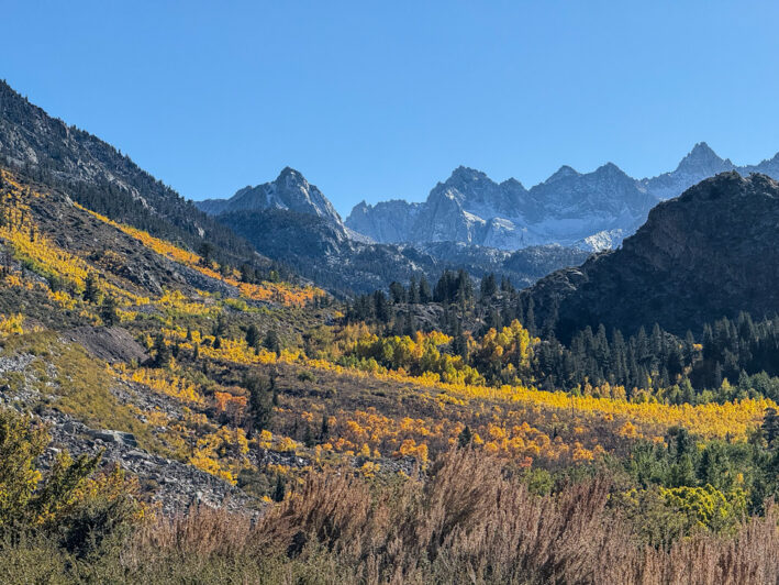
Approaching Monitor Pass.
Hungry for more? Ten Off-the-beaten-path places to see fall colors.
Day 2: North Up and Over Monitor Pass to Markleeville
As we ascended, the jagged mountains unfolded in every direction, unfurling a landscape of unearthly beauty. Some slopes were covered as far as the eye could see with blackened hulks – the ghostly remains of forests torched by recent wildfires. Gold and orange underbrush crept up and around the stumps, a poignant reminder of nature’s promise of continual renewal. Juxtaposed between the moonscape mountains were fiery slopes where everything from the weeds to the aspen glowed electric, as if plugged in.
Past the ghost town of Monitor, a rough-and-tumble 1860s boom-to-bust mining town that had a saloon and a brothel on every corner, the pass topped up at a high plateau of haunting beauty, where mirror lakes reflected every hue of autumn.
As dusk settled on the high country, we rolled into the hamlet of Markleeville, its tiny downtown anchored by the 1890s Markleeville General Store, where 12 inches of sawdust insulate the 14-inch-thick walls.
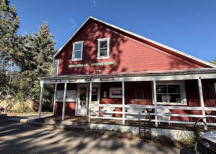
The Markleeville General Store.
After a soak at Grover Hot Springs State Park to celebrate arriving at the top of the first pass in one piece, we settled in at the rustic Creekside Lodge. About 15 years ago, I’d stayed here before embarking on the infamous California Alps’ “Death Ride” bicycle tour up and over Ebbetts Pass National Scenic Byway. True to its name, the grueling climb, which gained 14,000 feet in its leap up and over three mountain passes, had nearly killed me.
Even though I’d be doing the pass this time from the (relative) comfort of a car, then as now, the next morning I fueled up for the ride at the Upcountry Cafe, where the organic lattes and piggy bagels were as delicious as ever.
Day 3: West Up and Over the Ebbetts Pass to Murphys
The first time I’d climbed Ebbetts Pass, I’d been too exhausted to notice anything but the endless, agonizing miles passing slowly beneath my pedals. This time, I’d have more energy to take in the sweeping vistas along 61-mile-long Ebbetts Pass, a one-laner too narrow for a center line, and every inch of it crooked.
Like a maniac rollercoaster gone off its rails, the highway climbed up and around a series of steep switchbacks that were so tight I could see my taillights coming and going. We emerged from one blind curve to a drop-off that fell until tomorrow.

A caution sign for Ebbetts Pass.
The highway then leveled out and cruised past a nonstop succession of forests, lakes, meadows, volcanic vistas, crashing waterfalls, Giant Sequoias, and Quaking Aspen (clickclickclickclickclick—I could hardly capture the staggering beauty fast enough) before making the final push to the summit.
With many miles to go before Murphys, the historic wine town at the bottom, my cellphone suddenly beeped. As I shot it a glance—it was out of photo storage – Zoe let out a yelp. In my split second of distracted driving, the car had veered out of its lane (actually, out of the only lane) toward the edge of an abyss, a detour Zoe had no plans of taking with me. She slid across the back seat to the door and shot me a look that said, “Get me the hell out of this car, now.”
The Ebbets Pass Trailhead eventually (over many mountainous miles) connects to the 2,650-mile-long Pacific Crest Trail, which in its route from Mexico to Canada goes right past my house. When I told Zoe she could practically hike home from here, she shot down the trail like a bullet. I wasn’t sure I’d ever see her again.
Hungry for more? Get the best ways to take in the Death Valley Superbloom.
Day 4: The Magic of Murphys
From the pass, the highway dropped like a spent rocket past Hell’s Kitchen Vista, Scossa’s Cow Camp, and blink-and-you’ll-miss-it-Arnold before arriving at Murphys, the literal pot of gold at the end of the rainbow.
Nestled amid farms and vineyards, the bucolic 1848 gold rush supply town had everything two weary road warriors could ask for, all strung along a main drag nestled beneath a canopy of stately elms. There were shops, sidewalk cafes, bakeries, and restaurants, many housed in original brick goldrush-era buildings; live theater, art galleries, and museums; wine pubs and tasting rooms in lush garden settings where you could sample the local vintage; Victorian inns that once hosted General Ulysses S. Grant, Mark Twain, and Charles Bolton, aka the notorious outlaw “Black Bart.” At a designer boutique shop, the kindly owner fed Zoe gourmet treats and promptly dethroned me as Zoe’s BFF.

Stop into the Pooch Pantry in Murphys.
After an afternoon hiking the Arnold Rim Trail, a maze of multipurpose trails overlooking mountains and valley at 4,000 feet, we crashed at the elegant Wisteria Cottage at The Victoria Inn in downtown Murphys. With a fireplace, canopy bed, soaking tub, and front porch, the adorable cottage looked like it was on loan from Hansel & Gretel, and included a gourmet breakfast.

Rest up to see more fall colors in California’s High Sierra at Wisteria Cottage at The Victoria Inn.
Day 5: East Up and Over Sonora Pass to Highway 395
From Murphys, it was a quick drive to Angels Camp and Sonora, just a few of the many historic mining communities of The California Gold Rush of 1849 along Highway 49. We followed a portion of the 300-plus mile road through the Mother Lode’s patchwork quilt of mountains, valleys, and forests past historic railroads where you could climb onboard, on to hidden streams where you could pan for gold, and to Moaning Caverns, where you can zip line down into a secret chasm. Along the way were gracious gold rush-era hotels frequented by Theodore Roosevelt and John Muir.
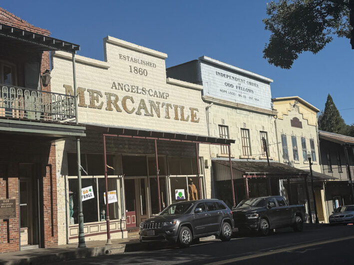
Spend some time in Downtown Angels Camp.
Just outside Sonora was the highway up and over Sonora Pass, one of the High Sierra’s most dizzying passes. We climbed into the inner sanctum of the mountains in a series of dramatic, white-knuckle ascents and descents, passing meadows sculpted by glaciers, and aspen flaming against towering granite walls; around gem-like lakes stashed in rocky crevices and through dark forests where moss and ferns thrived in the damp shadows. High above us, waterfalls tumbled from unseen heights, leaving silvery paths in the cliffs in their wake.
By the time the road had corkscrewed back down to Highway 395 and past Mono Lake’s blue-eyed stare, Zoe had jumped from the back seat to ride shotgun with me in the front, her nose pressed hard against the window.
Whether Zoe was cowed by the enormity of it all or pondering the loss (had she decided to hoof it home) of an excellent adventure, I’ll never know.
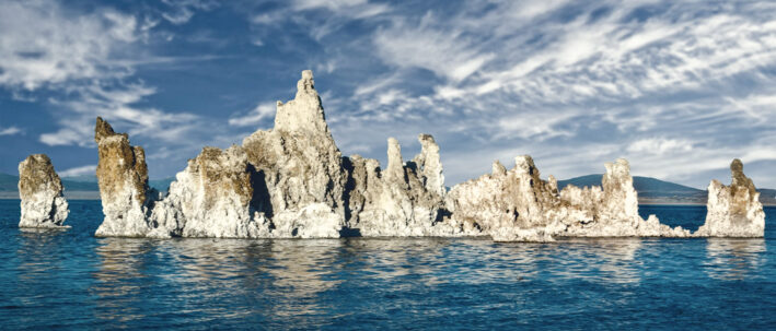
Mono Lake. Photo courtesy of Pixabay.com.
Click the links for more information about Leaf Peeping in California’s High Sierra. To book a room at The Victoria Inn, click here.
-Story and photos, except where mentioned, by Carole Jacobs, Real Food Traveler’s Health, Fitness and Spa Editor
Please note, the author was hosted for her stay at Wisteria Cottage to help facilitate this article but, as is always the policy at RealFoodTraveler.com, that does not influence our coverage.
This site uses an affiliate tool provided by the third-party provider Stay22. If you use certain affiliate links to make a booking or take advantage of an offer, I may receive an affiliate commission from this third-party provider. To determine whether you have used any of the affiliate solutions, the third-party provider will use cookies to attribute commission. These cookies will be removed as soon as they have served this purpose.







0 Comments